14.6.17 - 16.6.17
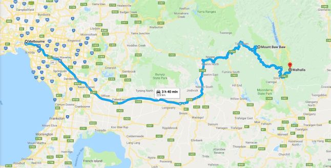
Located 3 hours east of Melbourne lies the magnificent Baw Baw national park. This park is home to part of the great 680km Australian Alps Walking Track, starting from Walhalla and finishing in Canberra. In addition to this giant hike, there is also an alternative hike that spans a 41.4km, 2 day hike from Walhalla to Mt Baw Baw (or vice versa); I decided to do this version and start this hike from Mt Baw Baw and descend to Walhalla. This hike was also undertaken during winter and consisted of trails covered in large amounts of snow.
 Day 1: The hike began around 9:00am at the Mt Baw Baw car park, climbing up besides skiers made it an interesting start to the hike... I eventually made it to the top of the trail in which I would officially start the hike. From there, I spent the first hour and a half getting lost by not reading my map properly, to find out that I had missed a turn off that would lead me in the right direction; I only saw two people on the entire trip and they looked like they were just doing day walks.
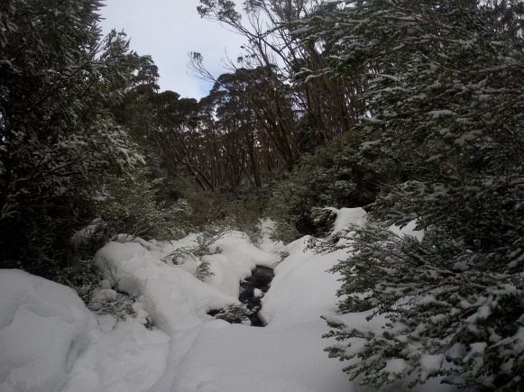
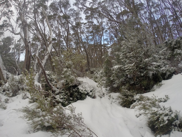
The trail itself was challenging as I had to use a compass to assist with directions as snow had completely covered the trail. However the knee - thigh height levels of snow did not bother me and I found it quite peaceful to be trekking in new conditions. Throughout the first day I had to walk through frozen creeks, adjust my clothing to prevent myself from overheating and then from getting too cold, cross narrow bridges and stay focused.
Day 1: The hike began around 9:00am at the Mt Baw Baw car park, climbing up besides skiers made it an interesting start to the hike... I eventually made it to the top of the trail in which I would officially start the hike. From there, I spent the first hour and a half getting lost by not reading my map properly, to find out that I had missed a turn off that would lead me in the right direction; I only saw two people on the entire trip and they looked like they were just doing day walks.
The trail itself was challenging as I had to use a compass to assist with directions as snow had completely covered the trail. However the knee - thigh height levels of snow did not bother me and I found it quite peaceful to be trekking in new conditions. Throughout the first day I had to walk through frozen creeks, adjust my clothing to prevent myself from overheating and then from getting too cold, cross narrow bridges and stay focused.
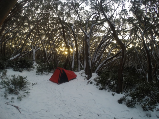
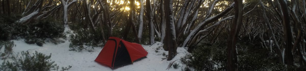
Towards the end of my first day I had been told that there was a strong possibility that there was going to be a storm coming through and that I should be all tented up around 6:00-7:00. Well it was past 7:00 and it was just about dark when I decided to pitch up tent at the nearest sight of flat ground, I had thought I would have made the 20km mark to the overnight camp site but I was wrong. I think that night was the quickest I had ever set up my tent ever, the weather turned violent and branches around me were falling everywhere; I waited for the morning.
Day 2: The next day I woke up at around 6:00am, I got out of my tent and was amazed with where I was. A beautiful orange and yellow sunrise that surrounded me through the trees was present (video on instagram) and there was the slightest breeze.The birds were chirping and there was not one person around me; I felt ready for the day.
 I ate breakfast, packed my tent and continued the hike while also wondering how much further I would have had to walk to make it to the camp site; seven minutes later and I was walking through the campsite... After passing through the campsite there were these enormous rocks that were called 'Mushroom Rocks', they were these massive rocks that looked like mushrooms; unfortunately I didn't take any photos of them but you can find them on the internet.
As the day went on I started my decent to Walhalla, which meant I could take my snow pants and jacket off as there was now dirt on the trail. This part of the hike was absolutely beautiful as I was surrounded by tall lush trees, ferns and patches of snow.
I ate breakfast, packed my tent and continued the hike while also wondering how much further I would have had to walk to make it to the camp site; seven minutes later and I was walking through the campsite... After passing through the campsite there were these enormous rocks that were called 'Mushroom Rocks', they were these massive rocks that looked like mushrooms; unfortunately I didn't take any photos of them but you can find them on the internet.
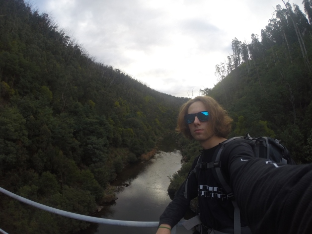
As the day went on I started my decent to Walhalla, which meant I could take my snow pants and jacket off as there was now dirt on the trail. This part of the hike was absolutely beautiful as I was surrounded by tall lush trees, ferns and patches of snow. 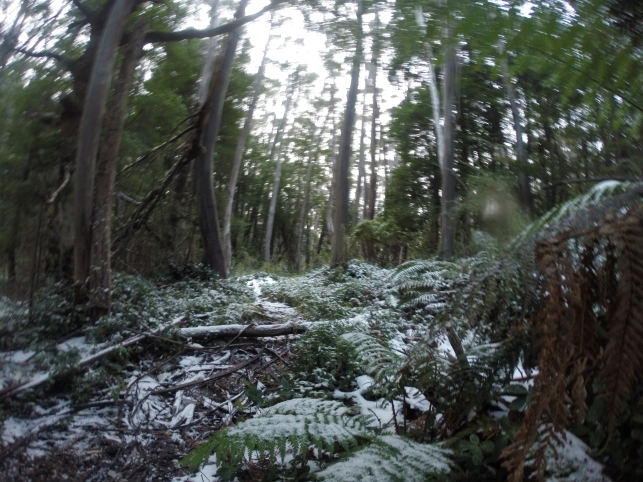 Around 5:00pm I reached the historical Tramway bridge which extends over Thompson river, this was a major milestone as I knew the end of the hike was near. The remainder of the hike took me through a steady but windy track along the side of the mountains which lead me to the great town of Walhalla.
 This hike would have to be my most challenging but favorite adventure that I have endured (so far). An extremely rewarding hike to do and full of history, it is definitely one that I would recommend but to those who feel comfortable with extreme conditions. I enjoyed hiking in the snow for the first time as it provided a brand new challenge, the scenery was amazing and I loved the tranquility it brought to me.
Harrison.
This hike would have to be my most challenging but favorite adventure that I have endured (so far). An extremely rewarding hike to do and full of history, it is definitely one that I would recommend but to those who feel comfortable with extreme conditions. I enjoyed hiking in the snow for the first time as it provided a brand new challenge, the scenery was amazing and I loved the tranquility it brought to me.
Harrison.
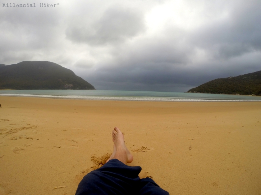
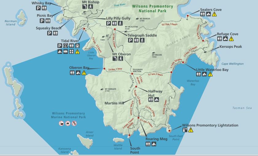 Day 1 consisted of hiking from Tidal River to Halfway Hut (12.3km), the large majority of this section was sand based and included crossing an extremely vast beach (Oberon Bay) until a narrow track took me through the shrubbery towards halfway hut.
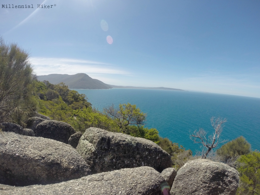
Day 2 led me from Halfway Hut to Refuge Cove (28.8km), this was a pretty intense day with the majority of the hike consisting of walking uphill. However also most rewarding, as I was able to visit the most southern lighthouse in Australia and discover the deserted beach of Little Waterloo Bay. Furthermore, from Little Waterloo Bay I hiked the remaining hours of daylight to Refuge Cove in which I set up camp for the night.
Day 1 consisted of hiking from Tidal River to Halfway Hut (12.3km), the large majority of this section was sand based and included crossing an extremely vast beach (Oberon Bay) until a narrow track took me through the shrubbery towards halfway hut.
Day 2 led me from Halfway Hut to Refuge Cove (28.8km), this was a pretty intense day with the majority of the hike consisting of walking uphill. However also most rewarding, as I was able to visit the most southern lighthouse in Australia and discover the deserted beach of Little Waterloo Bay. Furthermore, from Little Waterloo Bay I hiked the remaining hours of daylight to Refuge Cove in which I set up camp for the night.
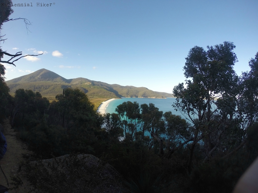 Day 3 brought the journey's end but also the most tranquil sights I had seen throughout the hike. From Refuge Cove to Mt Oberon and back to Tidal River (18.6km), I would have to say this was my favorite part of the hike due to the crystal blue waters and other empty beaches.
 I would recommend this hike to anyone who is just starting off, as you can choose sections of the hike to do and still return within the day or two. Below is a link to the actual site which can provide you with extra info.
http://parkweb.vic.gov.au/explore/parks/wilsons-promontory-national-park/things-to-do/southern-prom-overnight-hikes
Harrison.
I would recommend this hike to anyone who is just starting off, as you can choose sections of the hike to do and still return within the day or two. Below is a link to the actual site which can provide you with extra info.
http://parkweb.vic.gov.au/explore/parks/wilsons-promontory-national-park/things-to-do/southern-prom-overnight-hikes
Harrison. 